
The stone dike offers a solution to make a monument accessible for public as part of a wider amenity route.
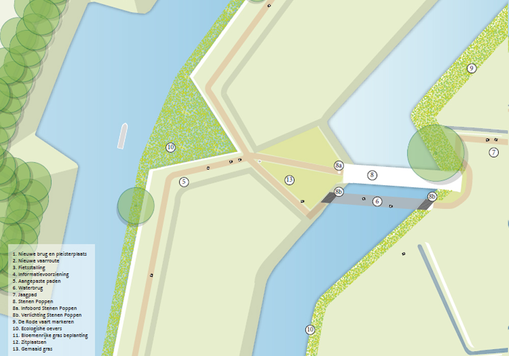
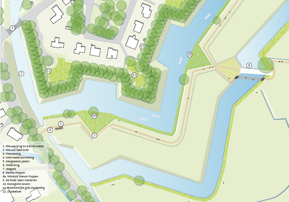
In 2019, the municipality of Moerdijk formulated its vision of the fortifications of Klundert after a broad consultation with residents and local parties. Our starting point was to develop the Stone dike in conjunction with the landscape with a great deal of attention for routing, visibility, banks and water quality and the provision of information. Part of the route is a spectacular water bridge with which you can walk right under the bear on the outer canal.
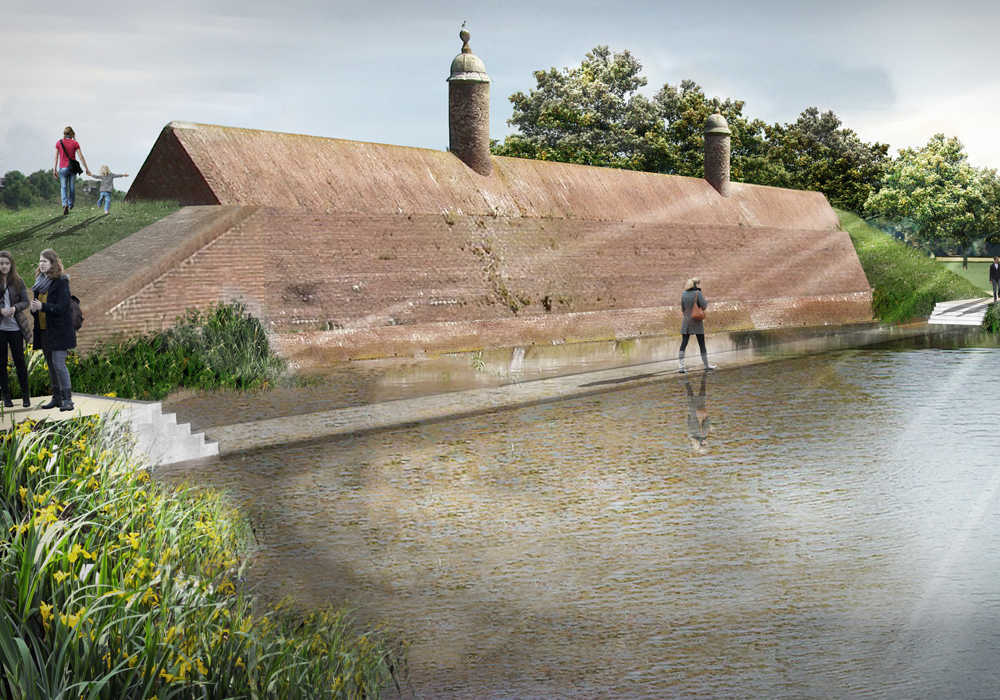
The Stone Dolls are listed as an important place, an eye catcher, with a lot of potential for improvement. The accessibility, visibility and readability of the fortress to which it belongs are important areas for improvement. Because even though the Stone Dolls are already an eye-catcher with their striking silhouette in the landscape, they are hard to see up close and it is not clear that they are part of the fortress. Landscape architects REDscape and DaF architects have been invited by the municipality of Moerdijk and the city table to develop a master plan for the Stenen Poppen to make it more visible and accessible and to strengthen the cohesion between Stenen Poppen, the landscape and the fortress.

If you approach Klundert from the south you will see the striking fortress contour with trees from the Suikerberg. To some extent, the Stone dike looms up, a monumental brick colossus with two columns. The whole is part of a beautiful city outskirts with water, slopes, paths and vistas that has great potential for residents, visitors and nature. A future-oriented development of the Stone Dolls and the ramparts ensures an integral improvement on all these points: strengthening the heritage and the tourist attraction goes hand in hand with strengthening the recreational value and the ecological value. Our starting point is therefore to develop the Stone Dolls in conjunction with the landscape with a great deal of attention for routing, visibility, banks and water quality and the provision of information. All these wishes must be integrated into the landscape. The Stone Dolls should not become a fairground attraction.

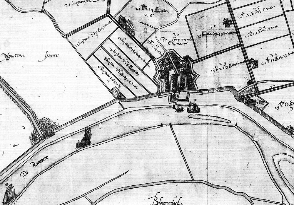
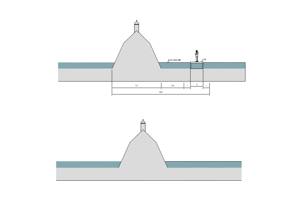
The fortress drawing of 1776 and the rebuild drawings are the starting point to re-route consistently from beforehand. The fortification structure becomes clearer if the glacis’ profiling on the control carp and the position of the covered road, the current walking path, is consistently implemented. In addition, attention is needed for the water structure. De Keene and its dikes are difficult to experience in the landscape. The water of the fortress is strongly divided. An investigation is underway into the restoration of the water structure and into the navigability of the moats. Along the inner canal, the banks can be made historically beating at places and thus a wet-dras area can be made with a lot of natural value. The Stone Dolls become more visible and accessible through the use of lighting and a new route. Part of the route is a spectacular water bridge with which you can walk right under the bear on the outer canal. The bridge is part of a route that runs from the fortress to the outside and with which the route of the dyke along the Keene is marked again. This also creates an interesting city-country walking connection that connects to the regional walking network in development. The information provision at the Stenen Poppen is integrated into a cornerstone that also brings back the original detailing of the Stenen Poppen. At the entrance of the hiking route on the Zevenbergerweg there will be a bicycle shed with integrated signs on the Zuiderwaterlinie house style.
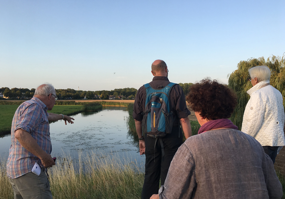
Client: Gemeente Moerdijk
Team: REDscape: Patrick McCabe, Antoine Fourrier, Bas Poppe En DaF-Architecten.
Status:Completed
Project area: 0.7ha
| Cookie name | Active |
|---|