Cambridge Road, Ringsend, IRL
climate-proof infrastructure to encourage active travel.
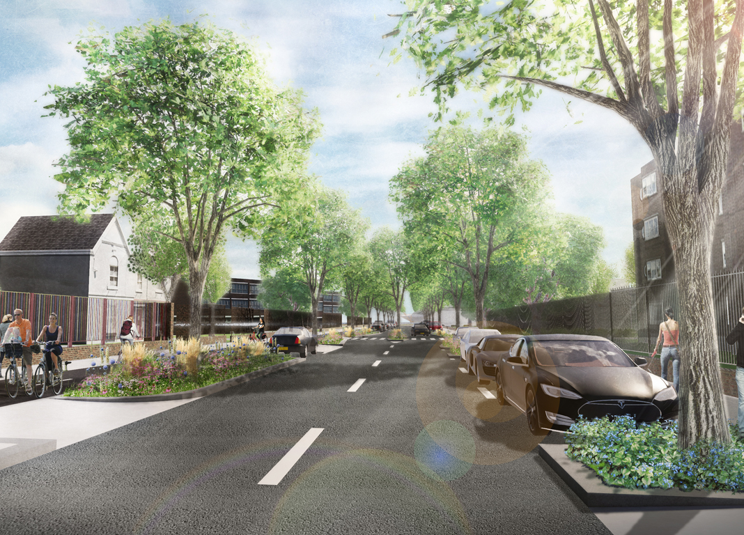
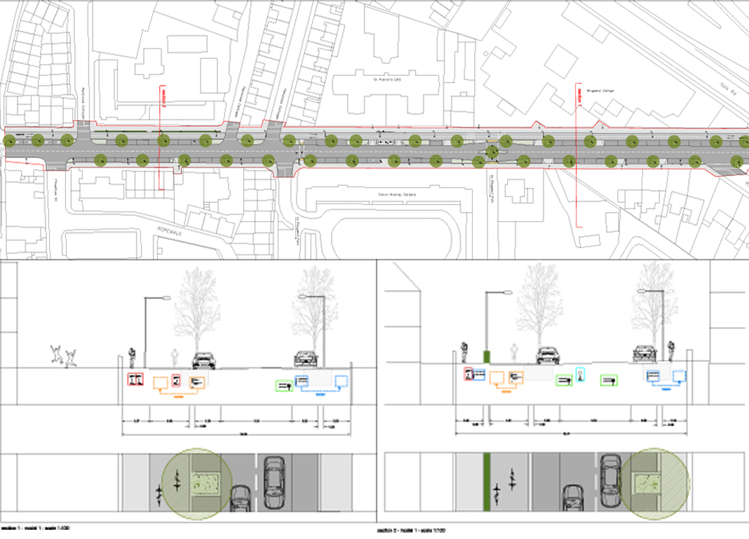
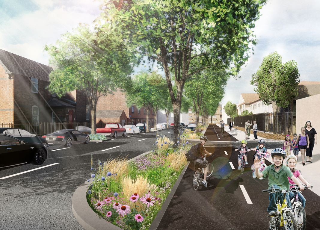
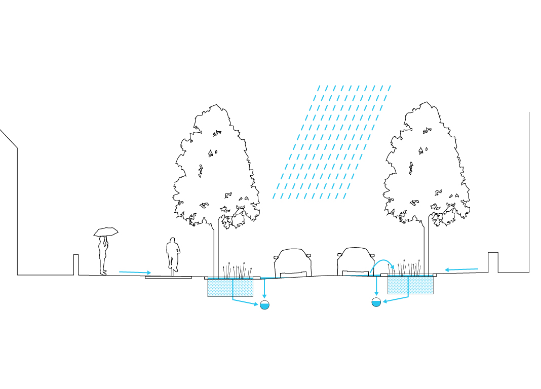
The safety of the roadway has been greatly improved by reconfiguring the width of the carriageway allowing traffic speeds to be reduced. An independent cycleway has been added to ensure children can safely make their way to schools and connect with other cycle routes in the area. This will greatly improve sustainable movement in the Ringsend area and make schools and colleges better accessible for teaching staff and students. An allocated space for collective (electric) car use has been proposed adjacent to Canon Mooney Gardens.
Following the development of a local area plan in Ringsend, Cambridge Road was earmarked by residents as a priority project for a village wide improvement scheme. Cambridge Road has two schools and a third level college. Despite the roadway’s extensive width, it is propped full of parking spaces, most of which are used by commuters to the city centre. Despite the width, the lack of visibility makes it hazardous in the mornings for commuters, and in particular schoolchildren, who walk through Ringsend park. It also connects two important bike routes, namely the Sandycove to Sutton and Dodder cycle routes.
Cambridge road is long straight road, reminding us of its origins as a former levee along Dublin Bay. This history is part of a wider reclamation scheme, which saw Ringsend, a former island in the estuary of the Liffey, being reclaimed into the mainland over several decades. Our vision recognises this history, while proposing several new directions for change. The road is need of a safe cycling route for schools and as a link between the city’s arterial cycle routes. A sustainable green layer is required to climate proof the road as it a low lying area and susceptible to flash floods. A new vision for parking is required to reframe the discussion from more parking spaces, to more ‘available’ parking spaces. The traffic issues of safety and speed require to be integrated into the new proposals.

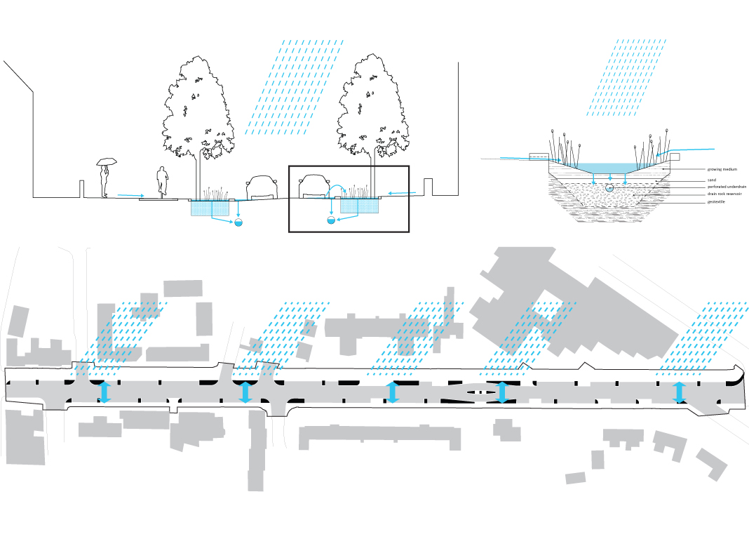
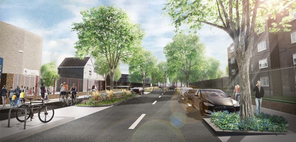
Following the assessment of several models, a new design for the road was proposed. The safety of the roadway has been greatly improved by reconfiguring the width of the carriageway from 9.1 to 6 m allowing traffic speeds to be potentially reduced from 50 to 30kmph. An independent cycleway has been added to ensure children (as well as adults) can safely make their way to schools and connect with other cycle routes in the area, such as the Dodder Greenway and the Sandycove to Sutton cycle schemes. An allocated space for collective (electric) car use has been proposed adjacent to Canon Mooney Gardens to optimise car sharing. The amount of hard standing has been reduced to allow for bio retention swales that act as a sponge for peak rainfall events. In combination with the new tree layer this will also enhance the biodiversity of this urban street. New crossing points have been created at the entrance to Ringsend Park where local children can safely commute to school. The issue of ‘available parking’ has been addressed by creating a design which allows for the possibility of resident permit parking to be introduced in the future. While the overall number of parking spaces has been reduced, the new design provides for better and safer connections to public transport and cycle infrastructure routes in the wider area. Better organised utilities allow for an attractive and sustainable tree layer to be planted in the street, which can be properly maintained. The tree root systems have been adapted to store sufficient water for flash flooding and climate change. Tree species are to be selected which won’t cause drippings onto cars. The kerbs are to be constructed with natural stone, to improve sustainability. The crossing point at the park entrance is to be marked with an art piece that relates to the history of the road and signals the park entrance to passersby.
Client: Dublin City Council
Team: Team: REDscape: Patrick McCabe, Antoine Fourrier, Bas Poppe
Status: Completed
