Bastion Groningen, Willemstad, NL
Redevelopment of the bastion as an experience landscape
Bastion Groningen offers a solution to reanimate the area as a visitor location for the fortress city of Willemstad.
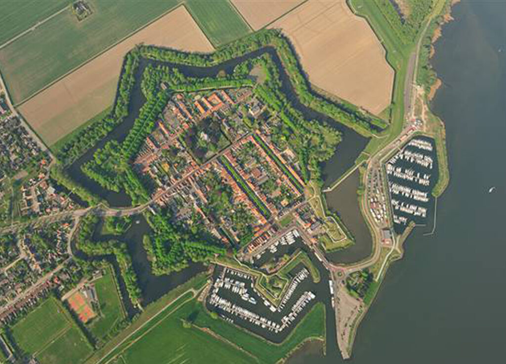
Bastion Groningen is one of the seven bastions in the Willemstad fortress built in 1583. Together with Bastion Gelderland, Bastion Groningen was added to the fortifications in 1602. They not only served to defend the port entrance of the city, but also played a key role in the defense of the Hollands Diep. Because of their location on the border between sea and land, both bastions were exposed to tidal influences and salt water. That is why they were given an outer covering in brick for reinforcement. The design of Bastion Groningen has been adapted several times in the course of history to the latest technological developments in the field of artillery and military defense. For example, gun places and an ammunition depot have been added.
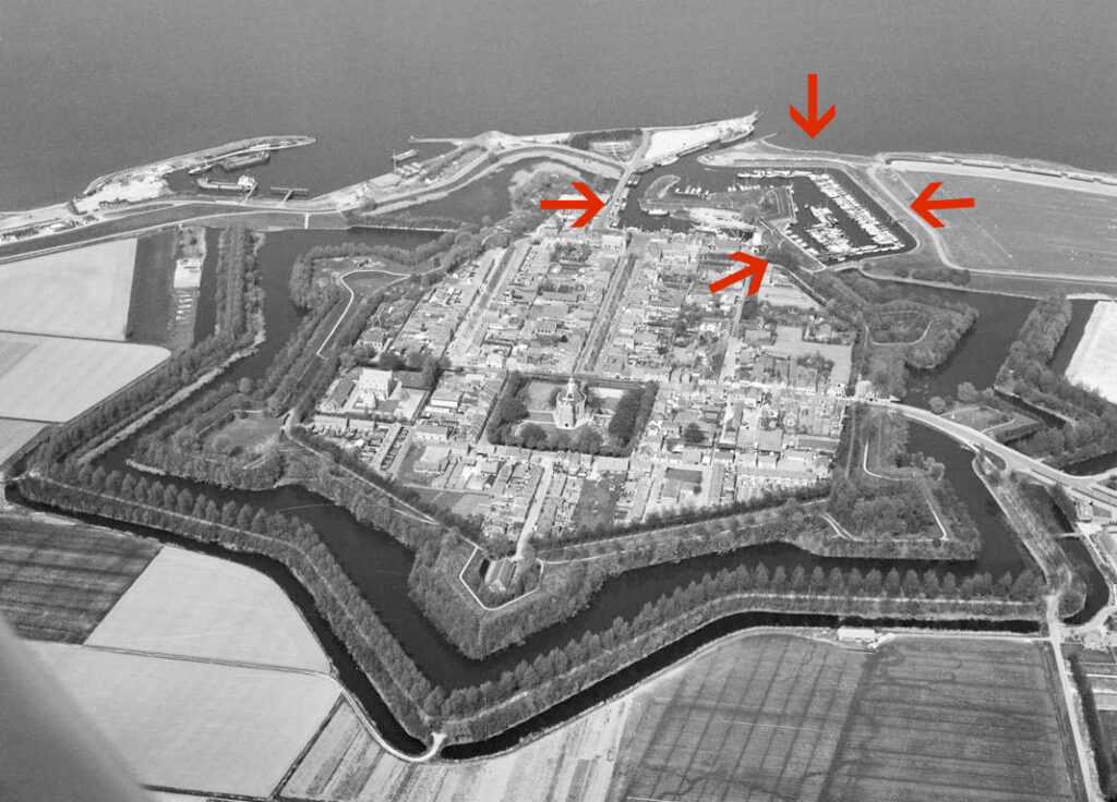
In 2019, the municipality of Moerdijk formulated its vision of the fortifications of Willemstad after a broad consultation with residents and local parties. In this the bastion is named as an important place, a pearl, with a lot of potential for improvement. The accessibility, legibility of the heritage and the development of facilities are important areas for improvement. Because even though the bastion borders the inner harbor of Willemstad with a fantastic view over the city, the waterfront, the ports and the Hollandse Diep, the bastion is rarely used and visited. It is hidden away. Landscape architects REDscape and DaF architects have been invited by the municipality of Moerdijk and the city table to develop a new master plan for the bastion to make it more visible and accessible and to activate the location.
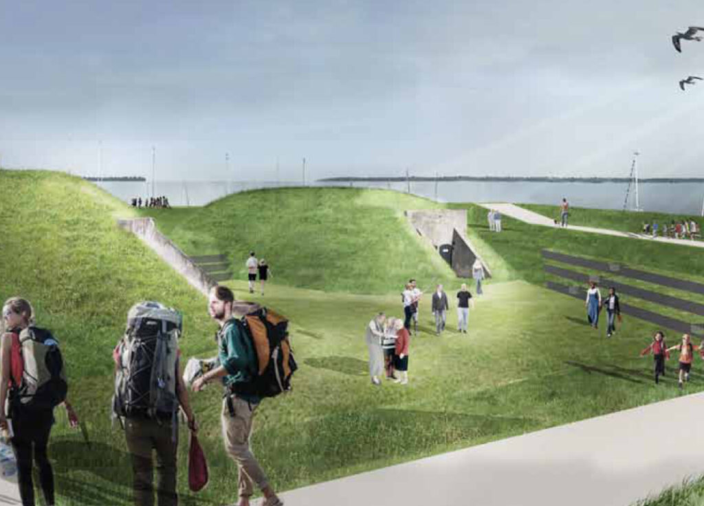
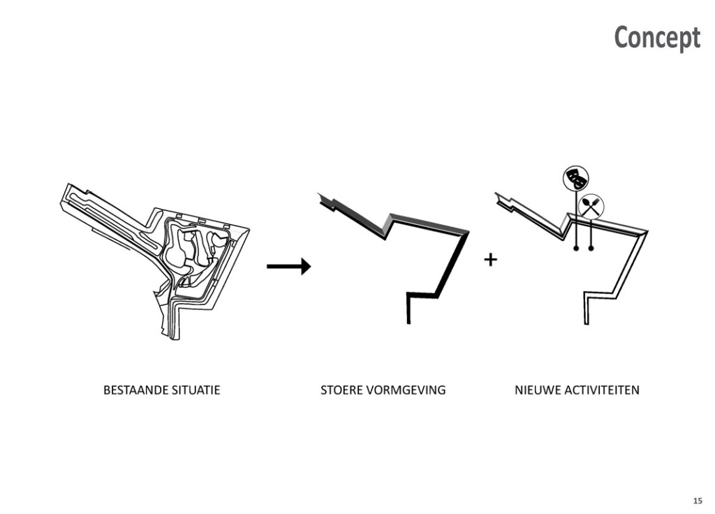
The bastion has the potential to become a place of significance for the residents and visitors of Willemstad in the coming years. The design team proposes to take the layered and rich history of the bastion as a starting point in this development. The various elements on the bastion reflect successive periods in the history of Willemstad. The design team discovered that not only this layering had melted into an unarticulated ensemble, moreover, the team found out that many of the qualities of the bastion had been disrupted over time, such as the routing of the paths and the profile of the works. The task is therefore to clarify and structure the various historical elements by unraveling and articulating.
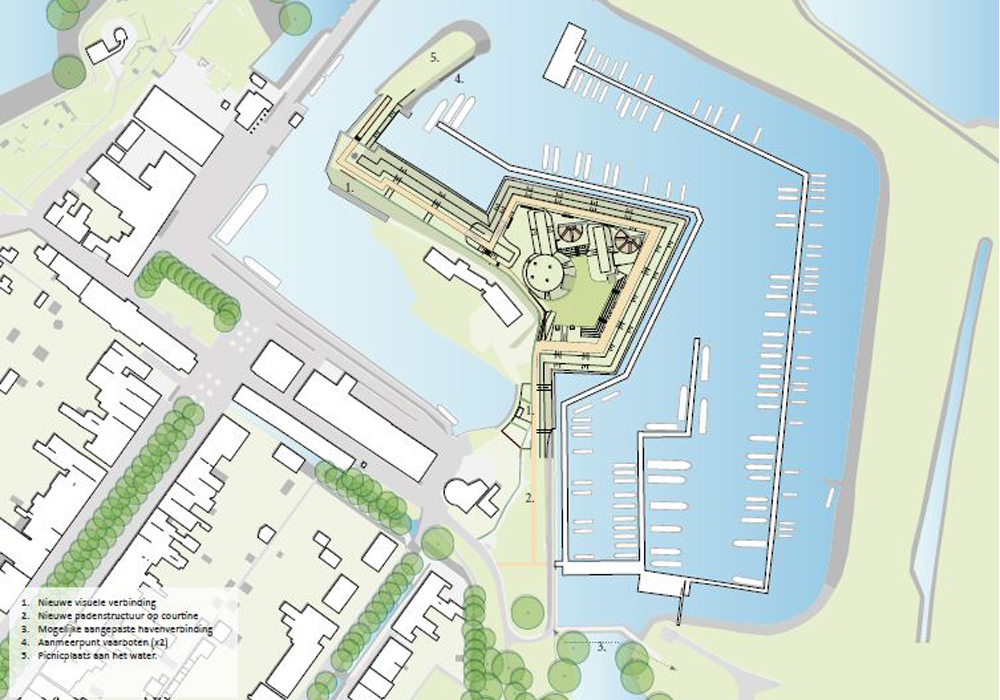
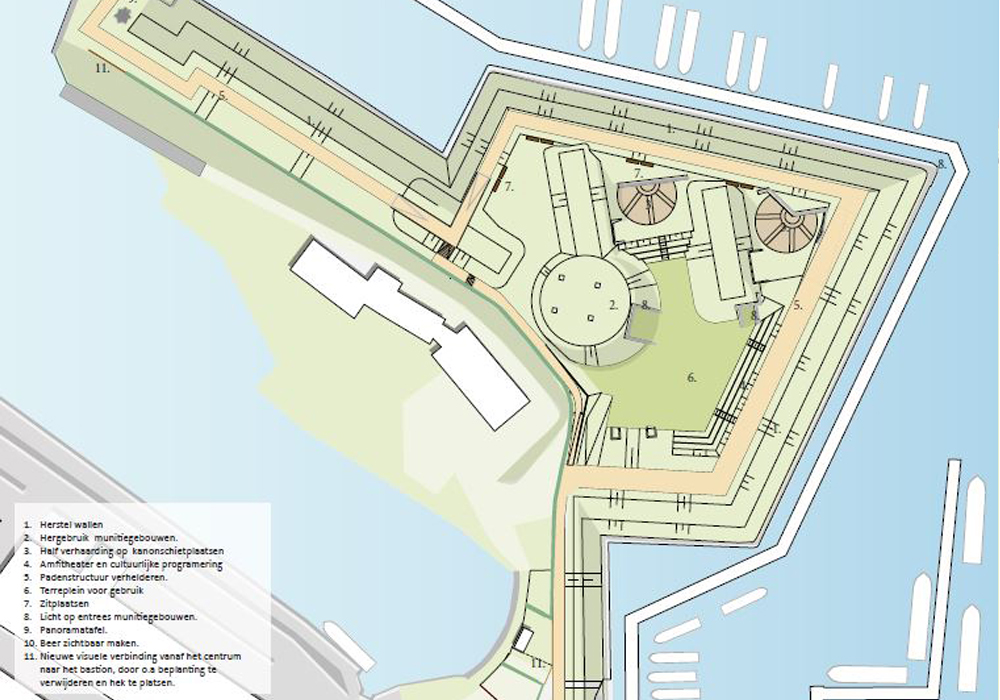
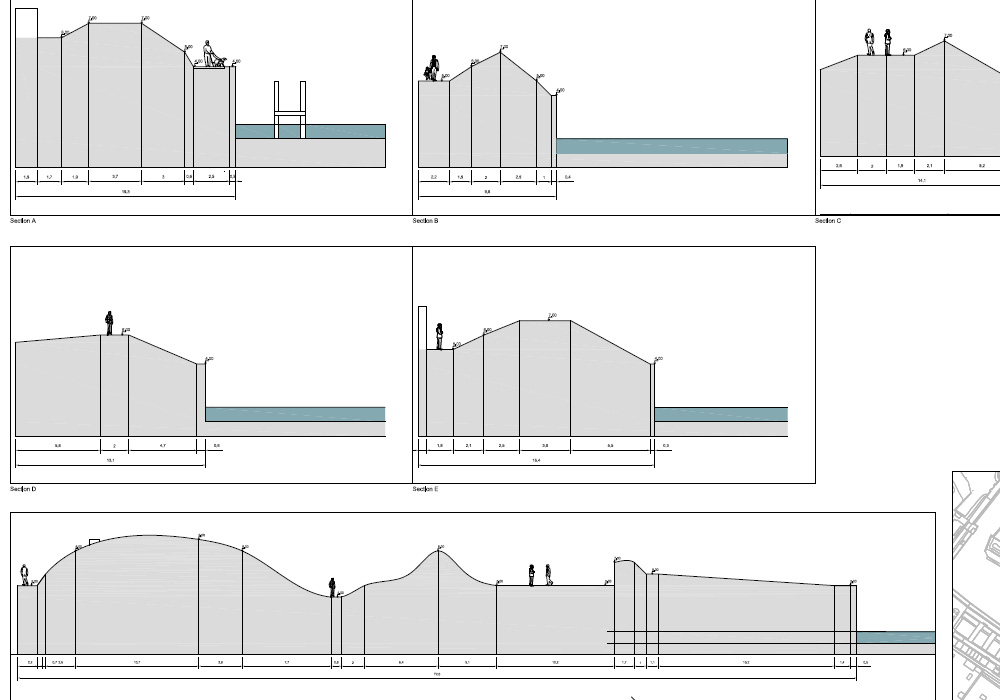
The plan drawing of 1865 is the important reference for redefining the bastion in its main form. New connections improve access to the bastion from the city center, as well as mooring places for boats from the harbor. Hedges are brought back into line with the historic military camouflage plantation. Other hedge sections are completely removed to make the bastion clearly visible from the city center. Routes are designed as covered roads to clearly reflect the historical qualities of the bastion. The paths have been broadened to make them more useful for visitors.
The interior of the bastion has been transformed into an amphitheater where cultural activities can also take place. A Terre Square (flat ground) has been defined to allow flexible use in the bastion. We have studied the military buildings (so-called ammunition buildings) on the possibilities for new use. The team proposes to make them accessible again for public visits. Some facilities have been added (such as water, electricity and toilets) to increase the flexibility of the fort in the future. A panoramic table on the works at the mouth of the harbor provides a visual accent and a place to stay at the end of the walk. Here the original function of the bastions is explained in word and image.
The spatial feasibility study into a physical connection between the bastion of Gelderland and Groningen has shown that this is too far-reaching and disruptive for the heritage value and the port function. On the other hand, a new entrance at the level of the lock next to the ship’s guard house and mill is feasible and will greatly improve the accessibility of the bastion. This also makes the characteristic lock part of a public walk. A promising development is also the new bicycle connection along the eastern bear. The correct integration and design of this element can contribute to the perception and accessibility of the bastion and the connection between the outer dike landscape and the fortress
Client: Gemeente Moerdijk
Team: Team: REDscape: Patrick McCabe, Antoine Fourrier, Bas Poppe Ism DaF-Architecten
Status: Completed
Project area: 0.7ha